
1. Boundary Details are now available
Zonegoat is a tool to help you simplify your search and due diligence. To make that process more efficient we felt that it was essential for you to be able to view the detailed information of those boundaries directly on the map.
Since we use third party data combined with our zoning algorithm we cannot guarantee the accuracy of each boundary. But we're confident that our application gives a very close estimate on whether a boundary should be of concern or not.
Being able to view the details of each boundary will give you the information you need to make better decisions.
2. Map Clusters
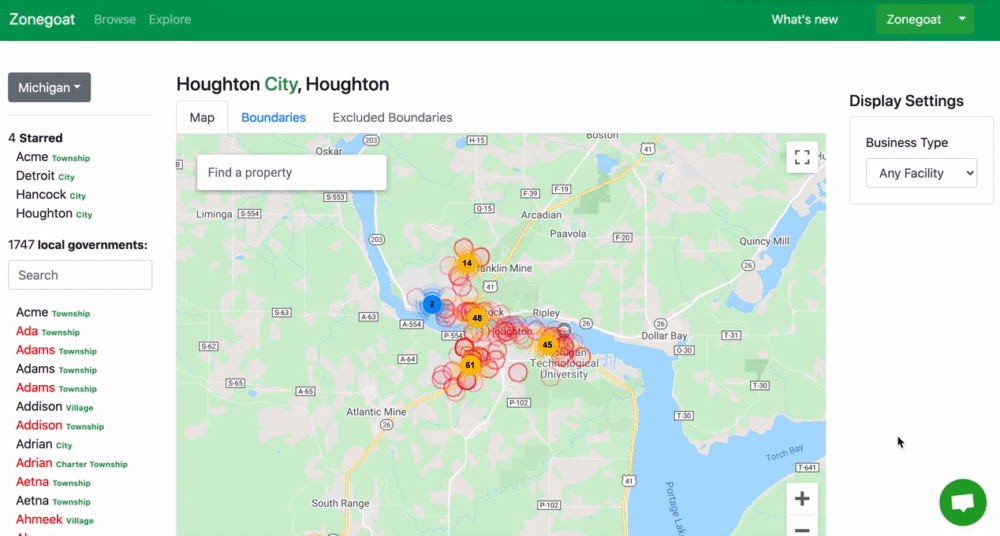
We've heard from you that sometimes there are so many boundaries that it's hard to count how many there are on the map. With this feature it will now be a breeze to navigate through boundaries on the map and count them. It will also allow you to focus in on the ones you'd like to analyze.
3. "Map" is now "Explore".

We've made so many updates to this feature recently that we felt that this feature has become much more than a map.
You can:
- View licensed marijuana businesses in a given municipality
- Identify potential boundary risks
- Uncover areas of opportunities
- Visualize buffer rules simulations
- an search for property of interest
But more importantly this feature is a way for users to explore areas of opportunities and simplify the due diligence process for Cannabis Zoned Properties. Since this feature is a way to Explore and analyze, we've decided to rename it "Explore".
4. Boundaries Tab

The boundary tab is a quick and easy way to go through every single boundary shown on the map.
PS. Now that each boundary buffers are clickable, you can also view the detailed information of a buffer directly on the map.
5. Excluded Boundaries
Sometimes the system collects boundary buffers based on incorrect details provided by third parties and/or the business owner of a location. When these boundary buffers are incorrect, our team manually excludes them from the map.
These excluded boundaries will appear in the Excluded Tab.
6. You can now generate reports for FREE

Our goal is to deliver as much value as possible. From your feedback we've learned that the way our report feature currently works is not of value to you. So we've decided to send this feature back to our lab and make it entirely free during the process as we will look for ways to make this feature more valuable for users in the future.
Boundary details that were once only available through a report are now available on the Explore feature at no additional cost.
If you'd like to investigate an area outside of the search radius used for generating the boundaries on the map, you can still use this feature to generate a report.
We want to build features that are useful and valuable to you. So If you have any suggestion on how reports should work in the future, please don't hesitate to send us your feedback by either commenting below or sending a feature suggestion here.
What's next?
The features we announced today are currently exclusive to the standard display mode of the map but you will soon be able to take advantage of these features in Simulation mode as well. 🎉
We are adding new data every day! Our next big bash of import will happen in the next few days. We will be adding Buffer Rules for 75 local governments and +500 municipalities links such as zoning ordinances and maps.
We are actively working to add:
- Zoning Zones Information for each municipalities which will be accessible from the Browse feature
- Measurement guideline for buffer rules which will be accessible from the Browse Feature
- Ability to display zoning districts for a local government directly on the Map. This feature will allow us to display boundaries not just based on buffer rules but also based on zoning district restrictions.
We hope you'll enjoy this big release. 🍻